Property Record
5610 Ogeechee Rd, Savannah, GA 31405
NEARBY LISTINGS FOR SALE OR LEASE
Property Detail
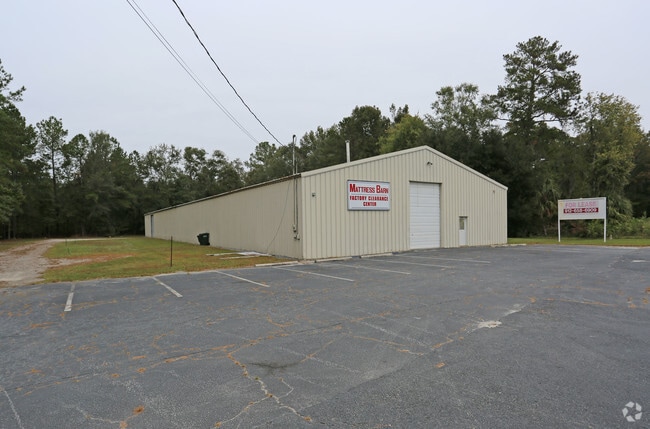
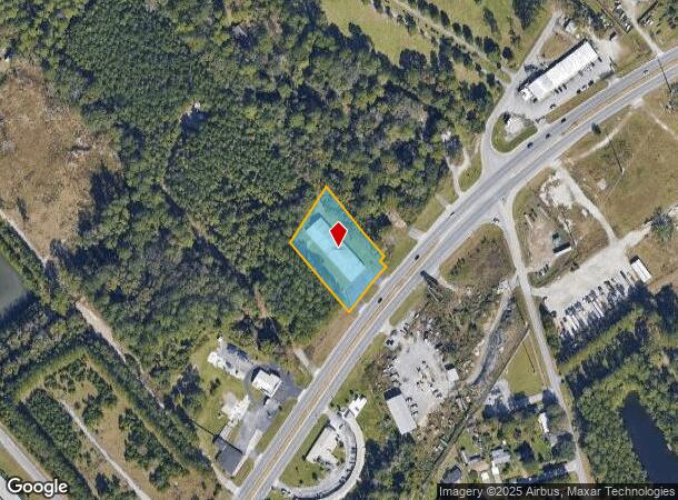
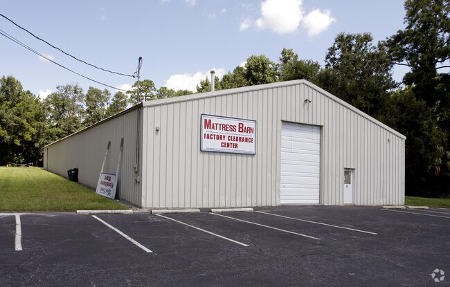
5610 Ogeechee Rd
1099101009
PT LT 1 ANDERSON TCT
Publicstorage
Chatham
X
Georgia
13051C0140G
1
2024
1.30 AC
2025
Outlying Chatham County
010812
Savannah
12,000 SF
Savannah, GA
DEMOGRAPHICS near 5610 Ogeechee Rd
1 Mile
3 Mile
5 Mile
2024 Total Population
3,580
22,950
69,765
2029 Population
3,711
24,027
72,572
Pop Growth 2024-2029
+ 3.66%
+ 4.69%
+ 4.02%
Average Age
39
39
38
2024 Total Households
1,327
8,937
27,066
HH Growth 2024-2029
+ 3.77%
+ 4.86%
+ 4.23%
Median Household Inc
$93,765
$70,733
$65,342
Avg Household Size
2.60
2.50
2.40
2024 Avg HH Vehicles
2.00
2.00
2.00
Median Home Value
$216,343
$215,710
$201,157
Median Year Built
2005
2003
2000
Nearby Places
Map Layers
Map Styles
 Street
 Aerial
- Restaurants
- Banks
- Shops
- Fitness
- Groceries
PUBLIC TRANSPORTATION
COMMUTER RAIL
DRIVE
WALK
Distance
14 min
6.9 mi
AIRPORT
Savannah/Hilton Head International
DRIVE
WALK
Distance
Savannah/Hilton Head International
18 min
8.1 mi
Nearby Properties
Address
Land Use
TOTAL SIZE
Lot Size
Zoning
Address
Land Use
TOTAL SIZE
Lot Size
Zoning
99.50 AC
M
Address
Land Use
TOTAL SIZE
Lot Size
Zoning
17,400 SF
19.34 AC
Address
Land Use
TOTAL SIZE
Lot Size
Zoning
70.49 AC
M
Address
Land Use
TOTAL SIZE
Lot Size
Zoning
942,210 SF
50.60 AC
Address
Land Use
TOTAL SIZE
Lot Size
Zoning
3,515 SF
61.21 AC
I1
Address
Land Use
TOTAL SIZE
Lot Size
Zoning
670,800 SF
43.38 AC
I-H
Address
Land Use
TOTAL SIZE
Lot Size
Zoning
34,980 SF
23.34 AC
PR3-16
Address
Land Use
TOTAL SIZE
Lot Size
Zoning
21,316 SF
26.07 AC
PUDM18
Address
Land Use
TOTAL SIZE
Lot Size
Zoning
33,510 SF
22.30 AC
PRM16
Address
Land Use
TOTAL SIZE
Lot Size
Zoning
12,560 SF
14.82 AC
PUD
Address
Land Use
TOTAL SIZE
Lot Size
Zoning
21.13 AC
PUDC
Address
Land Use
TOTAL SIZE
Lot Size
Zoning
6,580 SF
42.03 AC
PUDM-12
Address
Land Use
TOTAL SIZE
Lot Size
Zoning
413,230 SF
39.64 AC
M-CO
Address
Land Use
TOTAL SIZE
Lot Size
Zoning
8,208 SF
48.30 AC
PUDC
Address
Land Use
TOTAL SIZE
Lot Size
Zoning
26,124 SF
12 AC
BC1
Address
Land Use
TOTAL SIZE
Lot Size
Zoning
355,570 SF
25.41 AC
PIL
Address
Land Use
TOTAL SIZE
Lot Size
Zoning
12,560 SF
22.94 AC
PUD
Address
Land Use
TOTAL SIZE
Lot Size
Zoning
3,848 SF
9.14 AC
PBG
Address
Land Use
TOTAL SIZE
Lot Size
Zoning
28.95 AC
M
Address
Land Use
TOTAL SIZE
Lot Size
Zoning
79.49 AC
I-H
Address
Land Use
TOTAL SIZE
Lot Size
Zoning
3.69 AC
BC1
Address
Land Use
TOTAL SIZE
Lot Size
Zoning
58.54 AC
I-H
Address
Land Use
TOTAL SIZE
Lot Size
Zoning
32,712 SF
0.59 AC
Address
Land Use
TOTAL SIZE
Lot Size
Zoning
53.97 AC
I-H
Address
Land Use
TOTAL SIZE
Lot Size
Zoning
88,000 SF
9.62 AC
PIL
Address
Land Use
TOTAL SIZE
Lot Size
Zoning
119.35 AC
PUDIN
Address
Land Use
TOTAL SIZE
Lot Size
Zoning
70,384 SF
8.78 AC
PUDC
Address
Land Use
TOTAL SIZE
Lot Size
Zoning
8.58 AC
Address
Land Use
TOTAL SIZE
Lot Size
Zoning
27,914 SF
41.59 AC
Address
Land Use
TOTAL SIZE
Lot Size
Zoning
36,256 SF
15.81 AC
PUDC
The World's #1 Commercial Real Estate Marketplace
Connect with us
© 2025 CoStar Group
The information above has been obtained from sources believed reliable. While we do not doubt its accuracy we have not verified it and make no guarantee, warranty or representation about it. It is your responsibility to independently confirm its accuracy and completeness. Any projections, opinions, assumptions, or estimates used are for example only and do not represent the current or future performance of the property. The value of this transaction to you depends on tax and other factors which should be evaluated by your tax, financial, and legal advisors. You and your advisors should conduct a careful, independent investigation of the property to determine to your satisfaction the suitability of the property for your needs.